Role
Qualitative and artistic Research
Collaborators
Keystone Foundation, Indian Institute for Human Settlements (IIHS)
Year
2022
Objectives of the project were to:
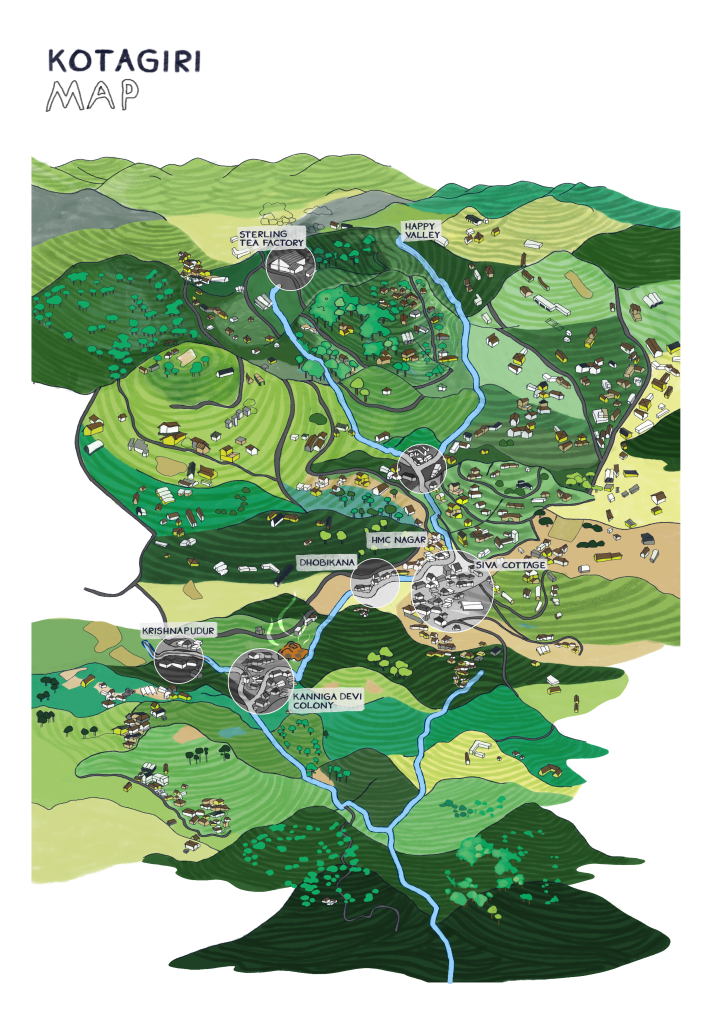
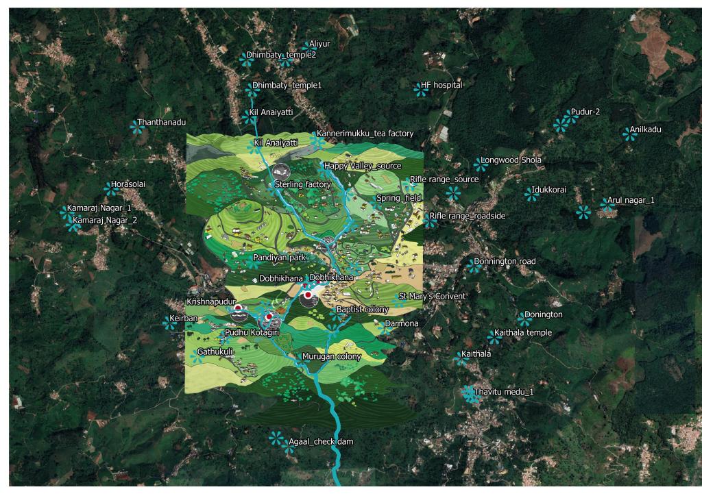
- To address the sanitation and water challenges in the hill settlements through a systematic mapping exercise followed by a layered representation of the interaction between the natural water source and waste & sanitation, and the various perceptions, interactions and socio-cultural relevance shared by each of the diverse communities settlements, and the key governance arrangements, specific to the area.
- To create awareness modules focusing on healthy water and sanitation practices
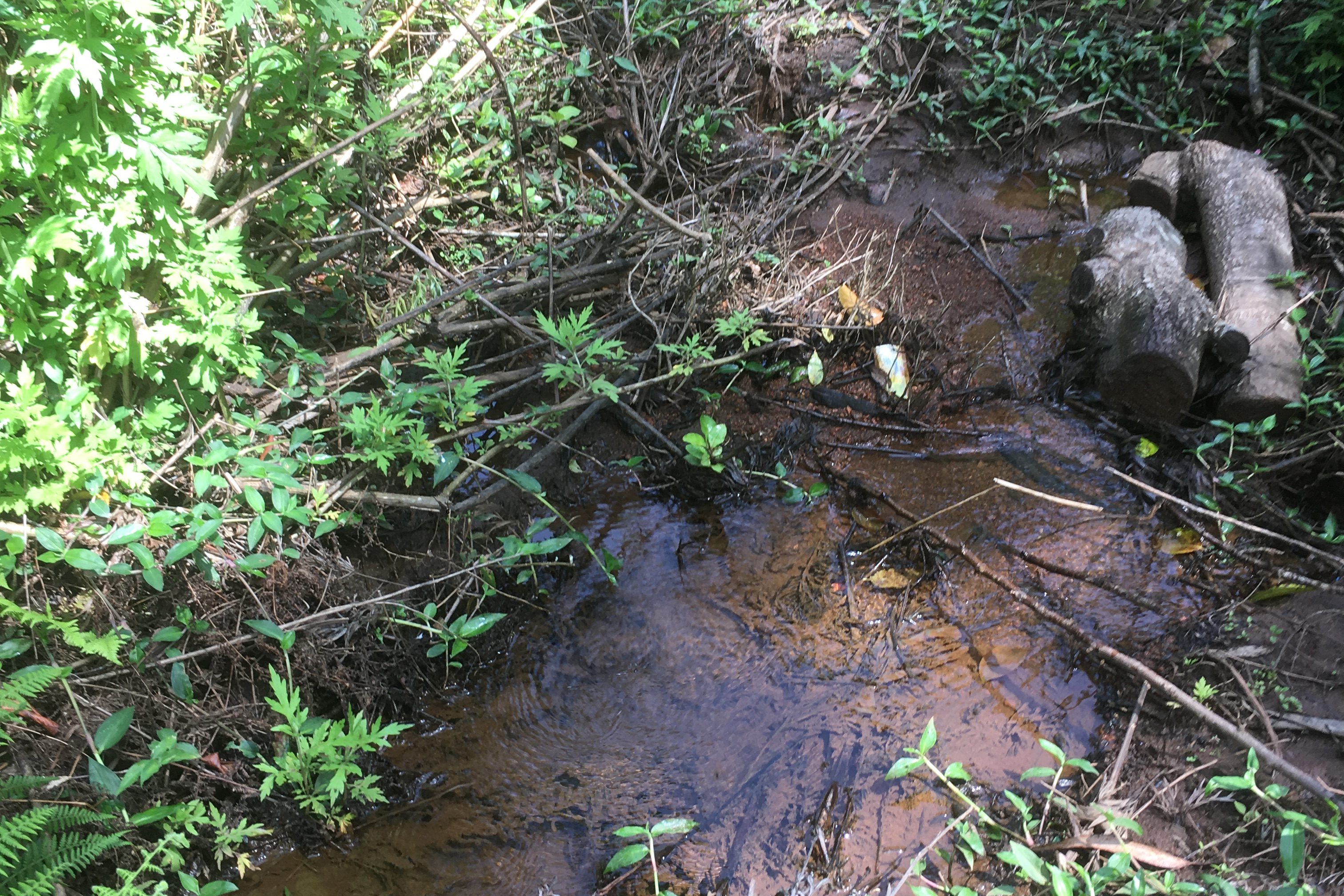
The focus was on two settlements in Kotagiri for the first phase of the project- Krishnapudur and Kannigadevi colony. The household populations of each of the two settlements is approximately 250 and 200 respectively. The two villages Krishnapudur (upstream) and Kannigadevi (down stream) are situated near the Kotagiri-Ooty highway at a 4 km distance from the Kotagiri town. The two settlements are connected through a stream that flows through them. The settlements consist of closely built houses which are congested, and the open drains are filled with grey water, food, plastic, fecal and other stagnating wastes, creating an unpleasant environment. The first level intervention included an illustration map that indicates the key water sources linking it to the two settlements, the land use activities surrounding it, sources of waste polluting the water, communities settled near the water body, their socio-cultural association or linkage to the water body, the key governance arrangements, and the nature of challenges – both felt and perceived through a GIS database. This was followed by creation of awareness and training materials for community based interventions and behavior change .